Structural Glaciological Analysis of the Antarctic Ice Shelves - Field Campaign 2025/2026

Monitoring the Critical Barriers Against Antarctic Ice Sheet Loss in the Age of Global Warming
This blog provides an account of the second field campaign (January–February 2026) of the international research project “Structural Glaciological Analysis of the Antarctic Ice Shelves,” funded by the National Research Foundation and the South African National Antarctic Programme. The project is led by the Polar Engineering Research Group (PERG) at the University of Cape Town. It brings together a multidisciplinary team of scientists specialising in structural mechanics, geotechnical engineering, geodesy, geophysics, glaciology, and electrical engineering.
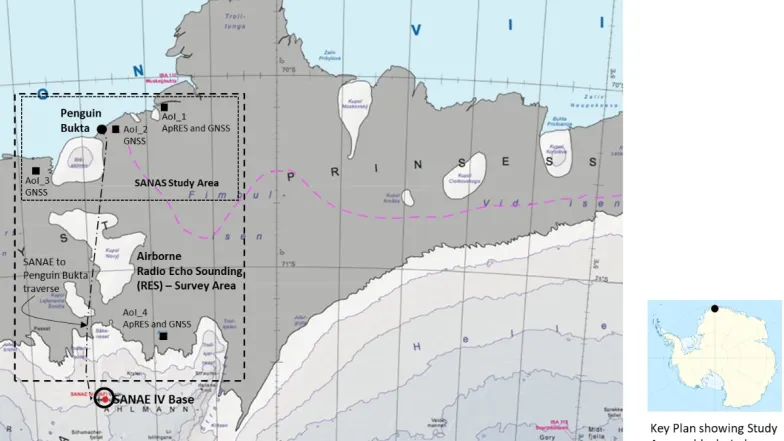
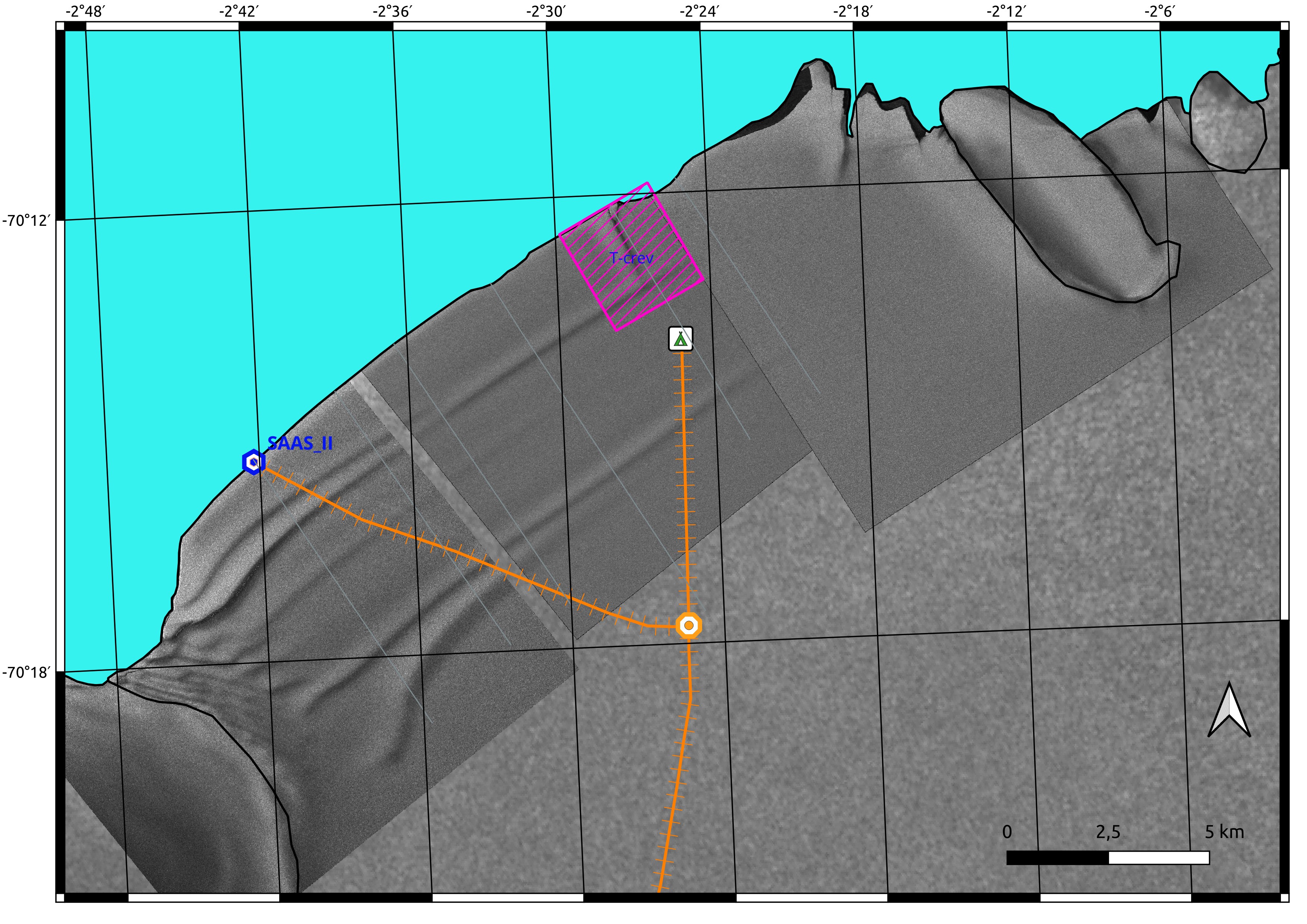
The project aims to monitor and investigate the current state of the western Fimbul Ice Shelf (Fimbulisen) shown above in dark grey colour and to assess future changes under the influence of global warming. The stability of Fimbulisen has direct implications for the volume of ice transported by the Jutulstraumen Glacier from the Antarctic continent into the Southern Ocean, and consequently for global sea-level rise. A key focus therefore lies in studying changes in Fimbulisen with respect to calving-front advance and retreat, ice velocity, structural integrity, snow accumulation, and basal melt rates where the ice shelf floats on the ocean.
The outcomes of this project will contribute to improved predictions of ice loss from the Antarctic continent. Such changes have far-reaching impacts—not only on Southern Ocean marine biogeochemistry and ecosystems, but also on global sea levels, ocean circulation, and the safety of low-lying coastal communities and infrastructure.
11 January 2026

After the SA Agulhas II arrived at Penguin Bukta, Antarctica, during the night of 2 January, the first priority was to identify a safe mooring and offloading site at the Fimbul Ice Shelf. Only once a suitable location had been confirmed could the UCT SANAS 2025/2026 Campaign Team—Prof Sebastian Skatulla, Prof Jay Pulliam, Dr Diego Quiros, Mr Alex Yumbu, Mr Daniel Njoroge, and Mr Tristan Firman—be deployed into the field with their equipment and supplies.
To support this decision, a helicopter reconnaissance flight was conducted with the help of Ultimate Heli along the calving front on 4 January. On board of the helicopter piloted by Sibongiseni Shandu and Kevin Kock were Prof Skatulla, Dr Hermanus van Nierkerk (University of Johannesburg), SANAE Supply Cruise DCO Mr Shiraan Watson, CAT train team leader Lourens du Plessis, as well as the ship’s Captain and First Mate. The aerial survey enabled the team to assess ice conditions and identify the most suitable and safest offloading point.
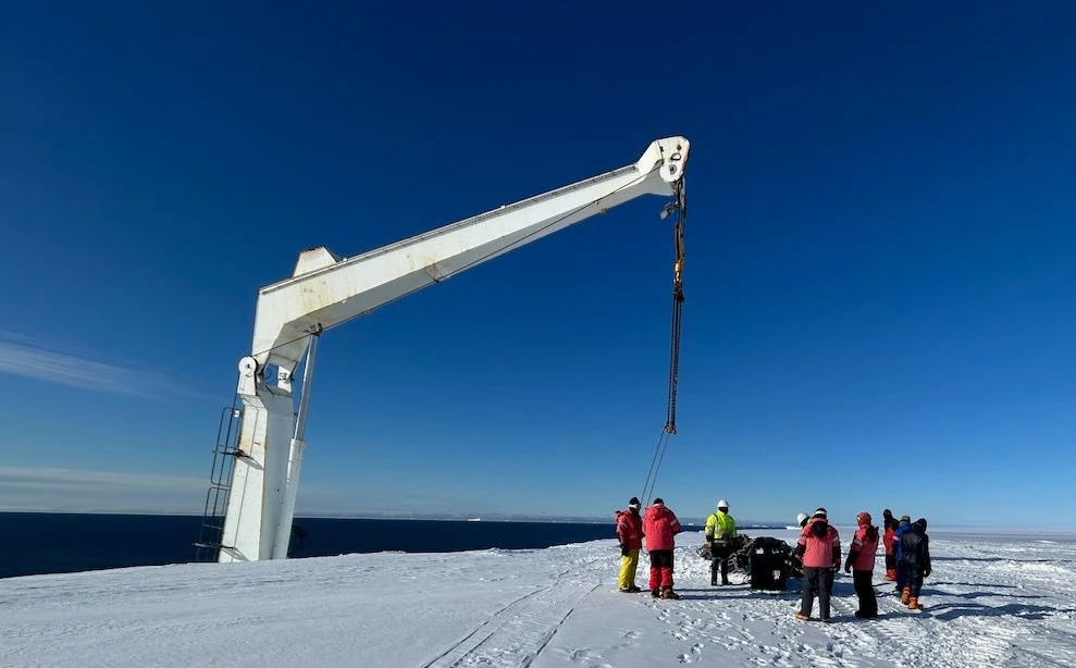
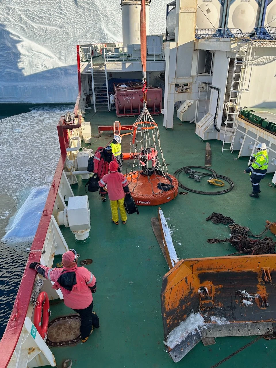
Following the site selection, Sebastian, Daniel, and Tristan were lowered onto the ice shelf using a man basket attached to the ship’s crane in the morning of the 5 January. Their task was to carry out an on-site crevasse hazard assessment using drone-based ground-penetrating radar. The radar data were processed later that evening and used to guide a final surface inspection with snow probes. A potential crevasse hazard located approximately 10 metres from the ice edge was clearly marked with bamboo poles, as shown in the image below.

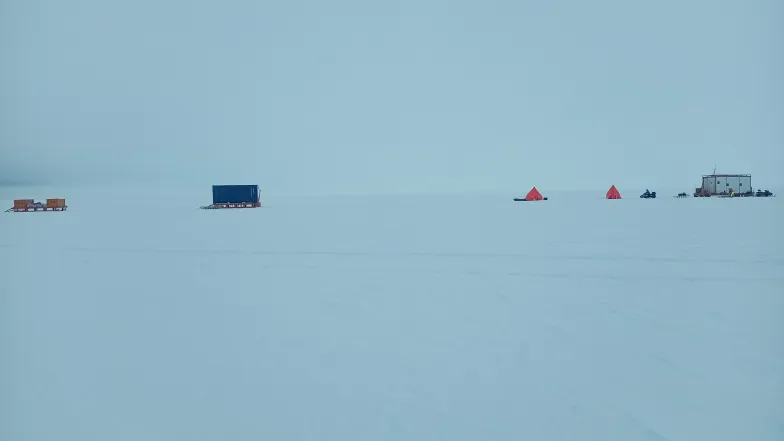
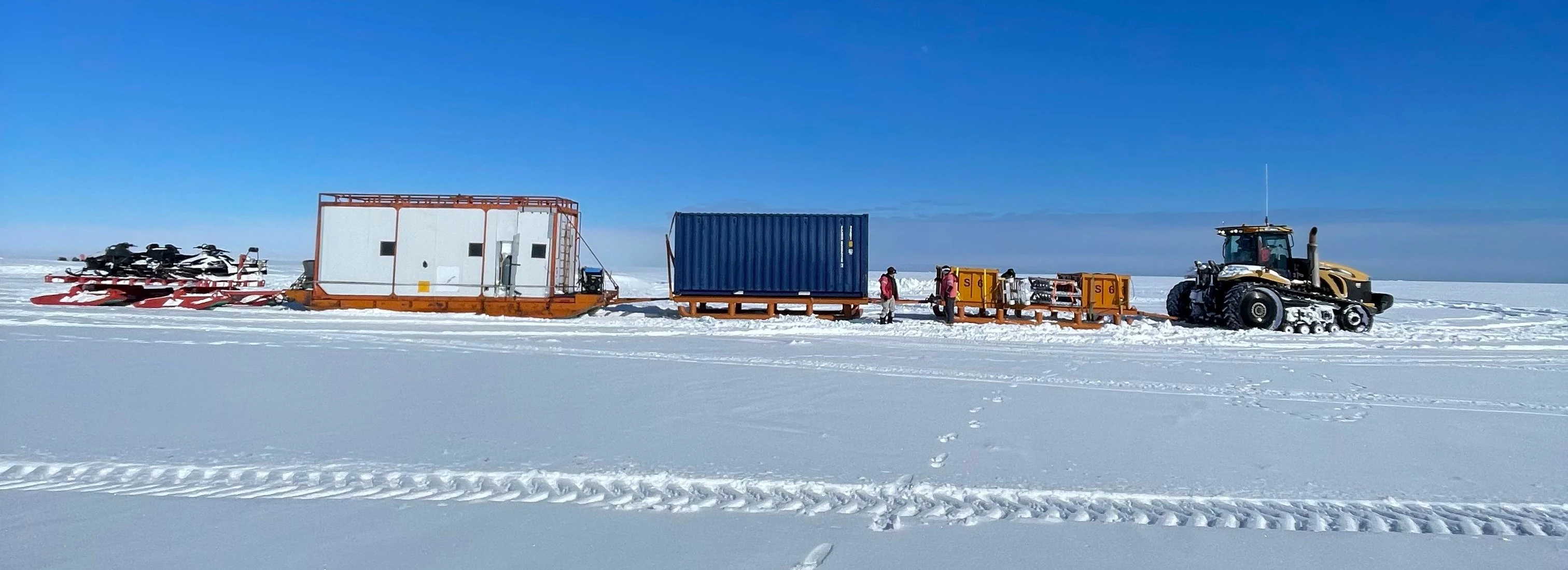
Once the initial cargo offloading operations were completed, the SANAS 2025/2026 Campaign Team was transported inland by CAT train. The UCT SANAS Team—together with their caboose and equipment containers (see image below)—was deployed approximately 11 km east of the ship's mooring station and 8.5 km west of the Apollo Island ice rises on the afternoon of 8 January, marking the official start of field operations.

The team has been busy establishing the field camp, which is expected to be completed today. Alex has set up a geodetic reference point on top of the caboose (see below) which will help the team to obtain accurate positions of points where the team will conduct measurements on the Fimbul Ice Shelf over the course of the next 5 weeks.

| 
|
Jay has been spoiling us with his impressive cooking skills, and the team remains in high spirits.
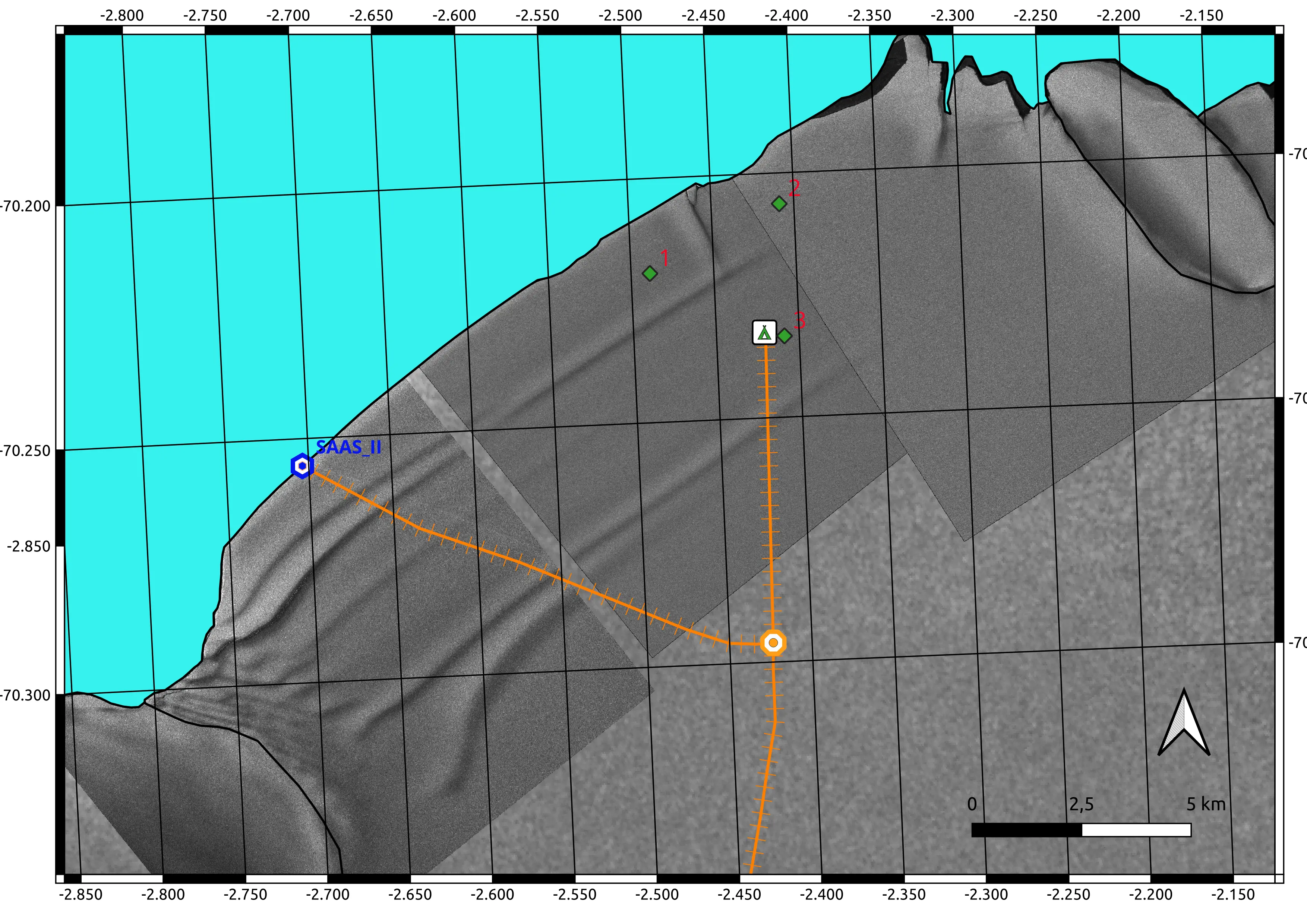
Weather permitting, the team will visit Permanent GNSS Station 3 (Global Navigation Satellite System) shown by the dark green diamond symbol below, located directly adjacent to the camp indicated by the green tent symbol, later today to retrieve ice-shelf motion data recorded over the past twelve months. The TerraSAR-X satellite image below also shows the Blaskimen Island ice rise in the southwest corner and Apollo Island ice rises in the northeast corner which are flat ice covered islands where the continuously seawards moving ice shelf is anchored.
15 January 2026
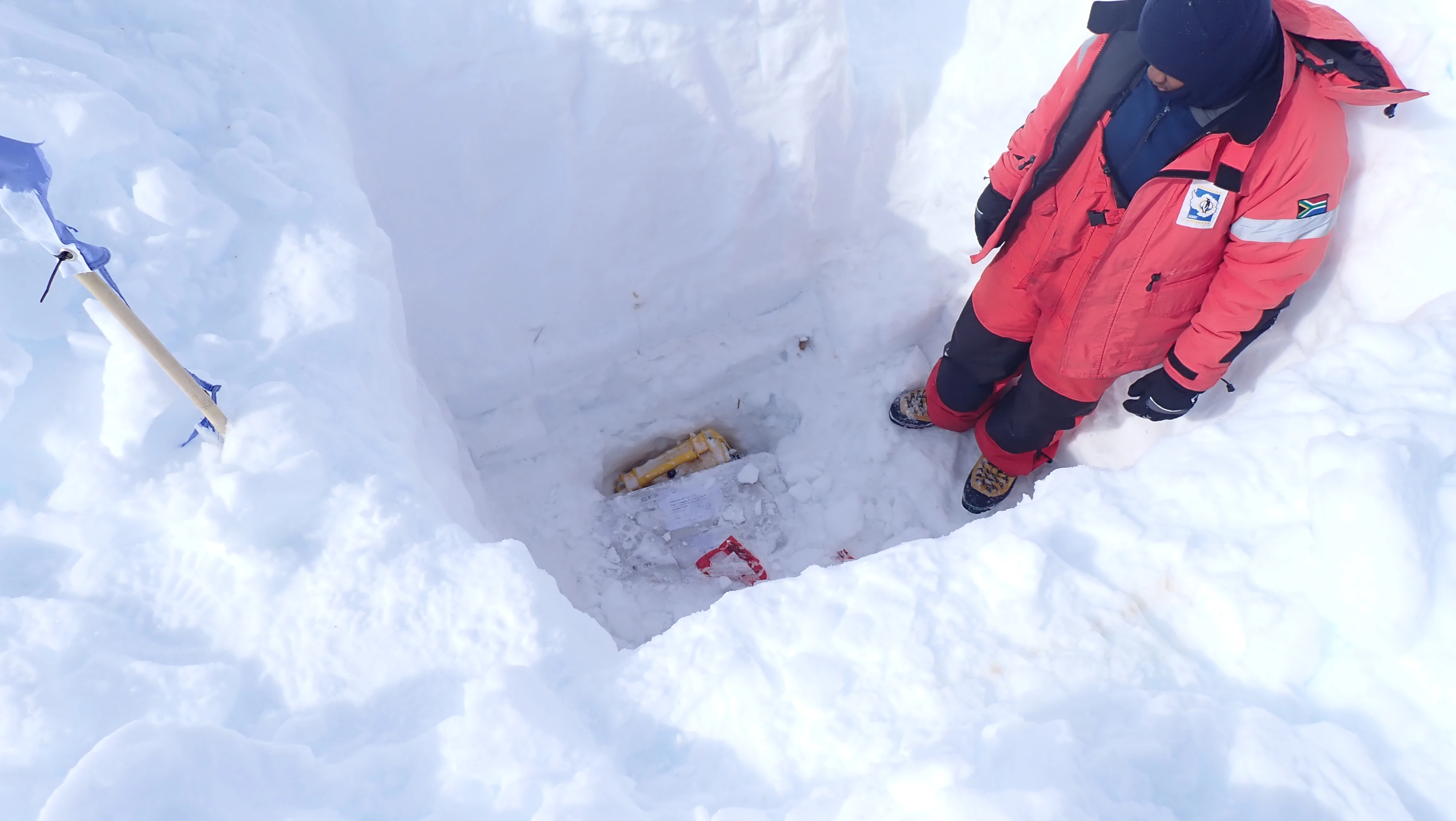
The weather on Monday and Tuesday was clear and sunny (for 24 hours a day!), allowing the team to retrieve the data recorders from the other two Permanent GNSS Stations 1 and 2. The two blue flags mounted on bamboo sticks mark the position of the GNSS data logger box, as shown in the image below, located approximately 2.5 m beneath the snow surface. Fortunately, the flags survived all the storms of the past Antarctic winter; otherwise, locating the buried box would have been extremely challenging. The truss tower adjacent to the flags supports a solar panel that supplies power to the GNSS data logger, while the small UFO-shaped disk at the top is the GNSS antenna, which receives satellite signals to determine precise station positions and, consequently, ice motion over time.

The three GNSS stations were installed around a T-intersection of two large fractures within the ice shelf that originate at the underside and propagate vertically upward—so-called basal crevasses. This configuration allows the team to triangulate fracture motion, monitor their continued growth, and assess the potential calving of a ~20 × 6 km² iceberg in not so distant future. GNSS stations 1 and 2 gave us excellent data. Unfortunately, GNSS Station 3 recorded data for only two weeks following its deployment last January. The team is currently investigating the cause of the failure, which may be related to the solar power supply, the lead-gel battery, the charge controller, or the device itself.
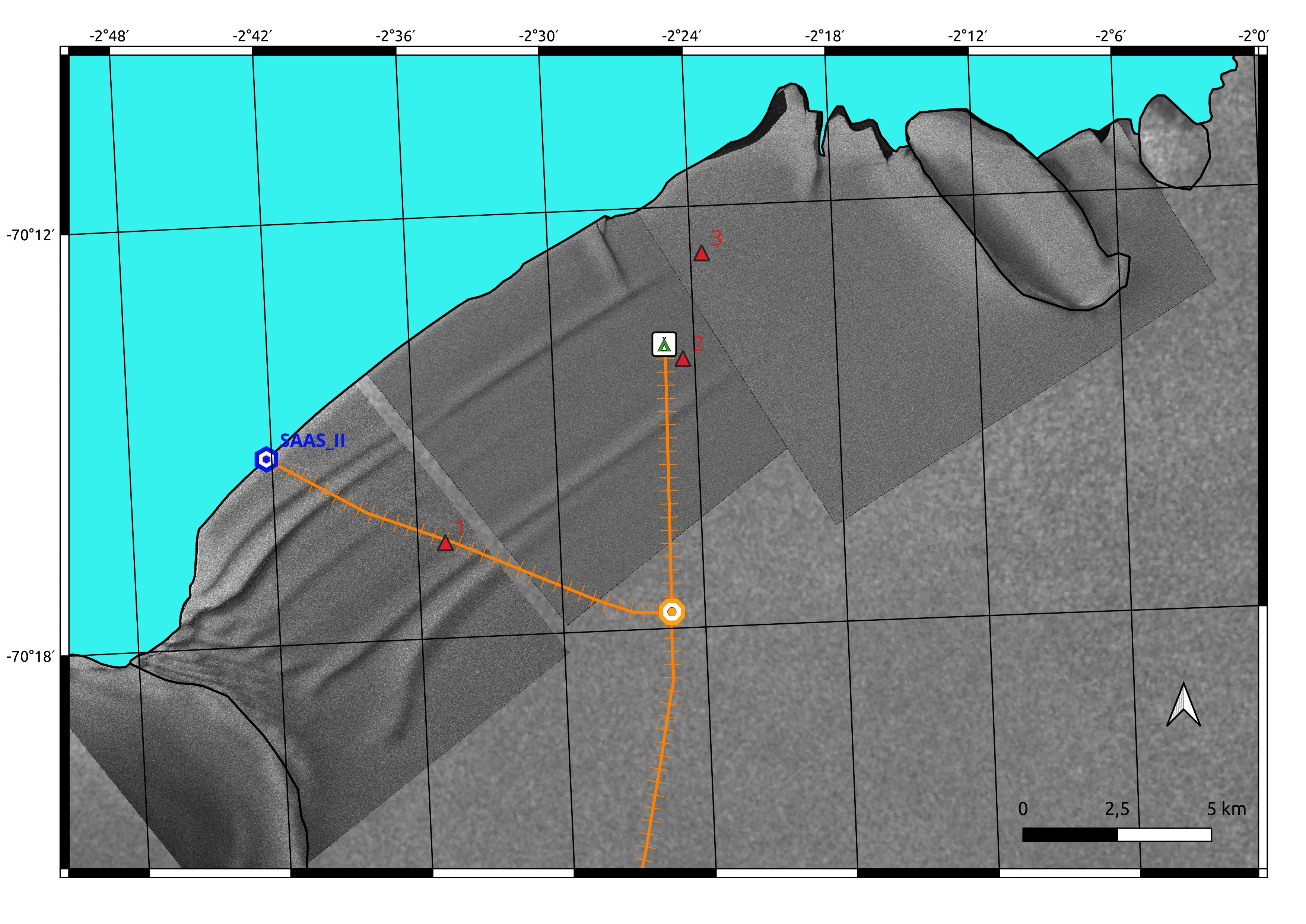
The team also visited Permanent pRES Station 2 (phase-sensitive radio-echo sounding) adjacent to the camp, indicated by the red triangle symbol in the figure below, and retrieved the data logger that recorded ice-thickness changes over the past twelve months. Thickness measurements obtained from this type of ground-penetrating radar are highly accurate and allow for the derivation of ice-thickness deformation rates and ice viscosity. These parameters, combined with GNSS motion data, are essential for parameterizing regional ice-shelf flow simulations that feed into global climate prediction models.
Yesterday, the weather was initially foggy and overcast, resulting in poor visibility. The team therefore waited until late morning to deploy 32 geophones along a 1 km line extending from the ice cliff land inwards near the ship’s mooring station (see the blue and white hexagon symbol labelled SA Agulhas II above). Sebastian, and Tristan conducted a preliminary reconnaissance of the area to assess potential crevasse hazards as shown below in the left picture. Diego, Jay and Tristan subsequently installed the geophone nodes (see below in the right picture Diego marking a geophone location with a bamboo pole).

| 
|
The geophones will record seismic wave reflections generated by a ground “thumper” - a Propelled Energy Generator (PEG) - which strikes a metal plate placed on the snow surface. The full seismic survey is scheduled for next week, weather permitting. Before and after the PEG operations, the geophones will also record “ambient noise,” capturing ground motion induced by ocean waves and other natural sources. Both passive (ambient noise) and active (PEG-induced) datasets will be used to determine ice thickness and material properties, including elastic parameters and density.

Today, the team prepared the camp for an incoming snowstorm, with wind gusts exceeding 100 km/h expected over the weekend.
23 January 2026
The storm hit us with wind gusts of up to 80 km/h and reached its peak on Sunday, with gusts exceeding 120 km/h combined with heavy snowfall. This resulted in a perceived temperature of −25 °C and visibility of less than 5 metres. These life-threatening environmental conditions made it impossible for us to leave the caboose and tents until Wednesday morning.
After the snowstorm had passed, the team spent the entire Wednesday freeing the caboose from a 3 m snowdrift build-up and digging out the toilet tent and the snowmobiles. The video below gives an impression of the snow drift occurred in the camp.
Tristan attempted to fix the electric generator, which stopped working during the storm. The generator is essential for heating the caboose and charging the batteries of various scientific equipment, laptops, and mobile phones. Unfortunately, there appears to be an issue with the carburettor, which may have been damaged. Tristan hopes that warmer weather might resolve the problem.
Yesterday, Daniel conducted a ground-penetrating radar (GPR) survey of the crevasse T-intersection around which the previously mentioned pRES and GNSS equipment has been deployed, as shown above. The radar scans provide detailed insights into the approximately 200 meter thick ice shelf beneath us, including basal topography, ice thickness, and the location and penetration depth of hidden basal crevasses originating at the underside of the ice shelf and propagating vertically upwards. These basal crevasses can also be indirectly observed in the satellite Synthetic Aperture Radar (SAR) image above (courtesy of the German Space Agency). However, SAR can only detect surface depressions forming above major basal crevasses that have propagated sufficiently far. As a result, crevasse penetration depth and width cannot be determined remotely using SAR and instead require ground-based field surveys. Daniel’s survey repeats last year’s measurements to study the progression of the T-intersection crevasse over the past twelve months.
Today, the wind picked up again with very unpleasant sleet snow drift not allowing fieldwork unfortunately. Instead, Sebastian and Alex practised the deployment of the pRES equipment. Jay and Diego charged with the small mobile generator the remaining 120 seismic geophones needed for the deployment at the crevasse T-intersection and the bathymetry (seafloor topography) survey of the channel under the ice shelf between Blaskimen Island and Novyy Island.
Tomorrow's forecast is only slightly better than today and it is uncertain whether field operations will be possible. The weather god has not been with us so far this year.
31 January 2026
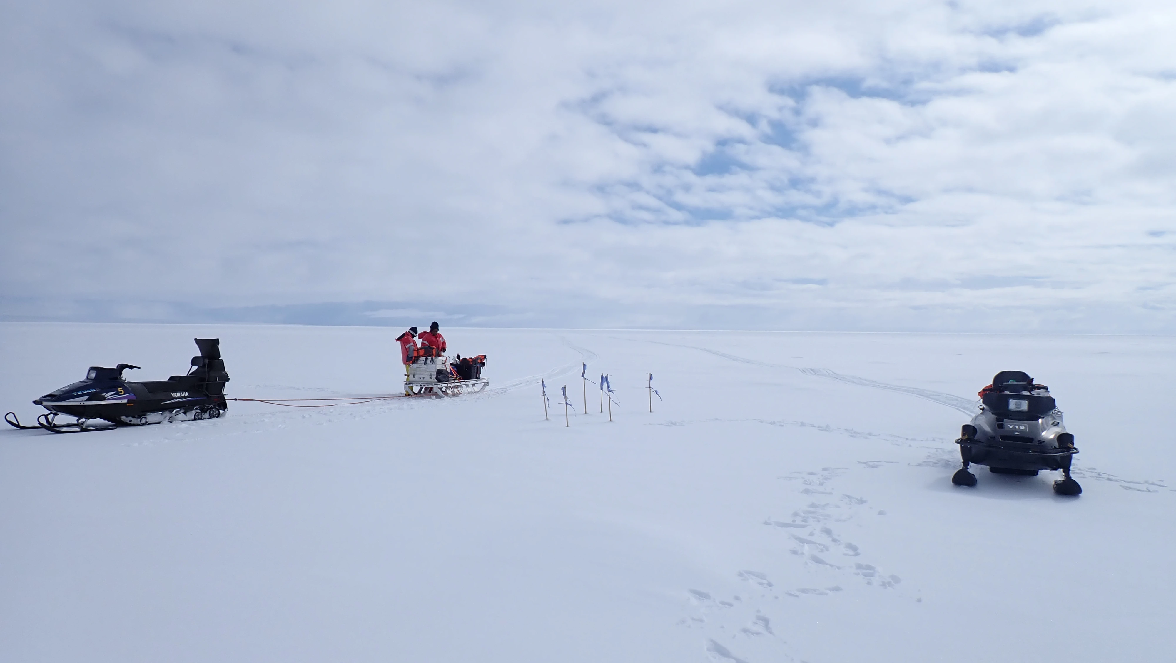
Last Saturday, the wind calmed down in the afternoon. Alex and Tristan went into the field and deployed three GNSS receivers for 72 hours at Temporary GNSS Stations 1, 2 and 3 to obtain accurate position fixes. The antennas were mounted on the same aluminium poles that were used for position determination and left in the field last year, as shown below. In this way, the ice flow that has occurred at these positions over the past twelve months can be computed.

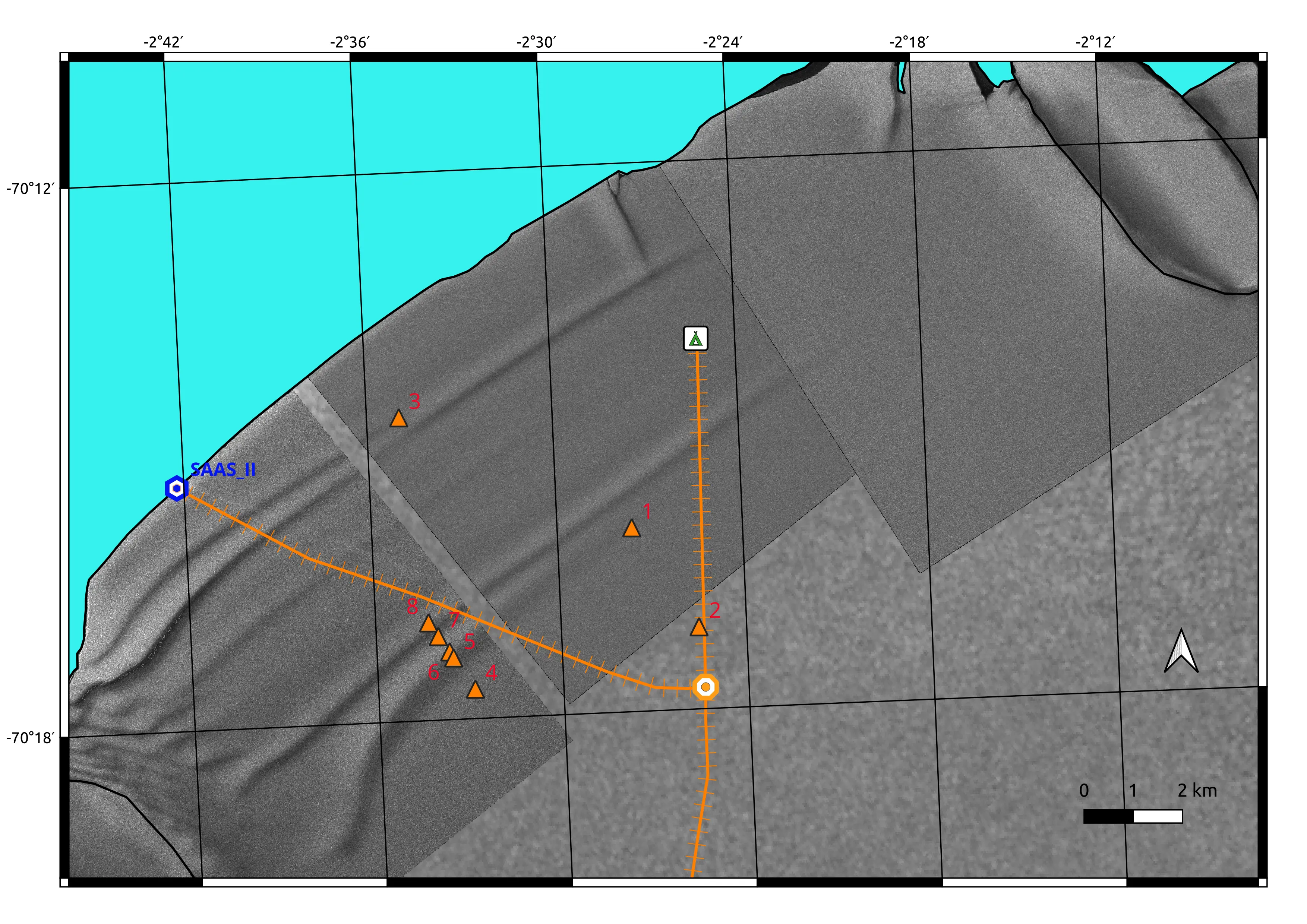
All poles had originally been installed 2 m above the ground, but after twelve months of snow accumulation the pole tips were barely visible above the surface, and one pole was completely buried. Fortunately, the bamboo markers with blue flags, which had been installed 2.5 m above ground, remained visible and allowed the buried aluminium antenna pole to be located. The station locations are shown in the map below.
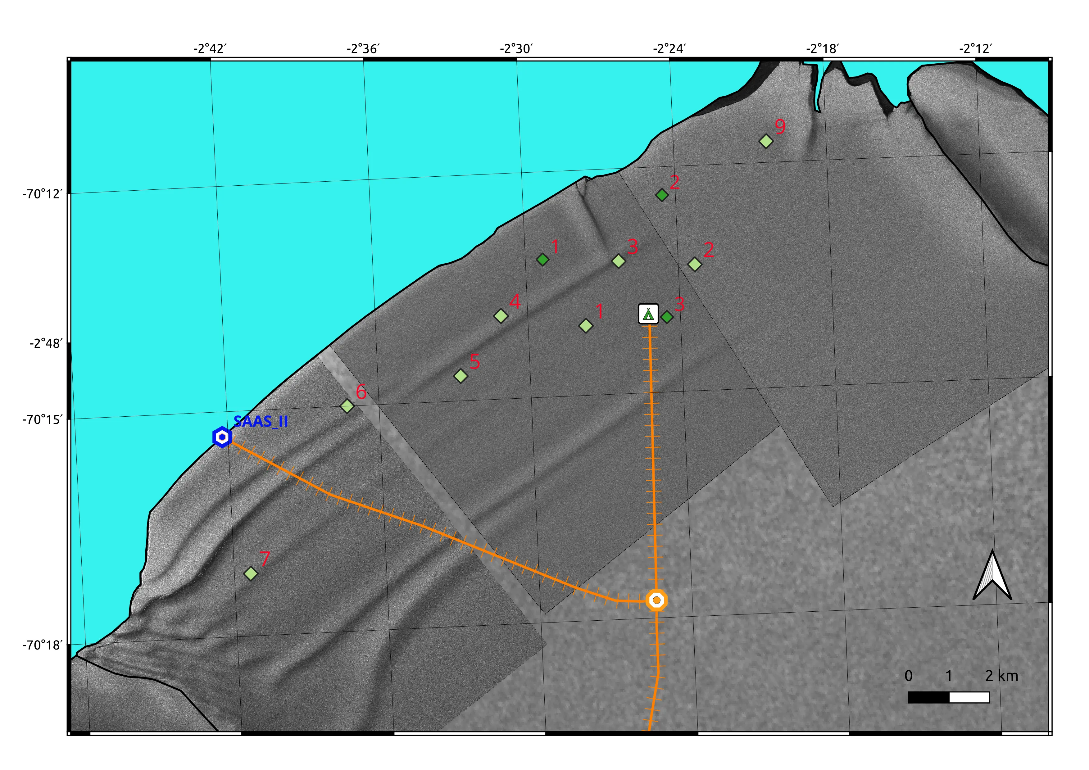
These three stations, together with five additional sites along the entire calving front between Blåskimen and Apollo Islands, will allow Alex to determine ice shelf flow spatial variability in terms of both magnitude and direction over the past twelve months.
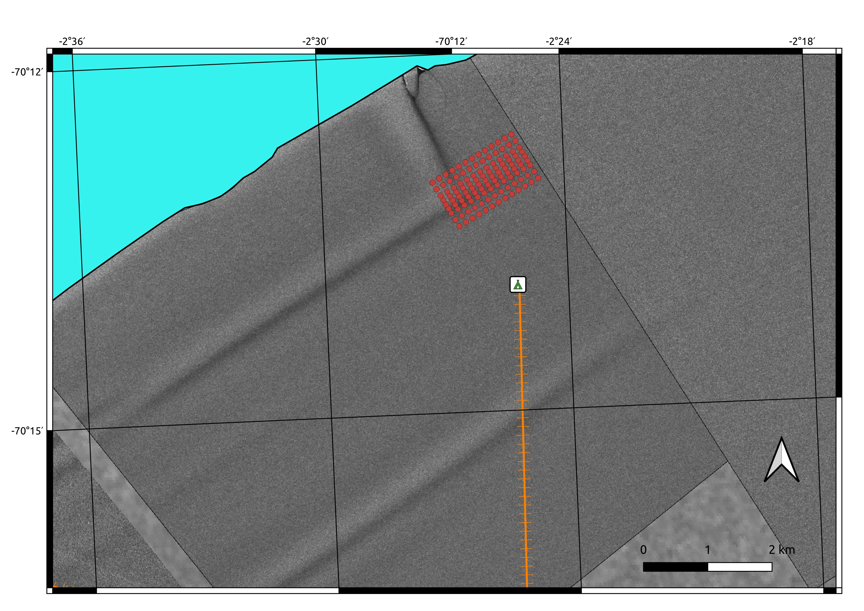
On Sunday, Sebastian, Alex, and Daniel redeployed a pRES instrument at the Permanent pRES Station 2, which will again record ice thickness changes and basal melt rates over the next twelve months. They then proceeded to the Permanent pRES Station 3 to retrieve the pRES data logger installed there. Meanwhile, Diego, Jay, and Tristan deployed 70 of the planned 120 seismic geophones on a 2 × 3 km grid just above the crevasse T-intersection, as shown below by the red circles.
Each geophone is marked with a bamboo as illustrated below on the left so it can be found later when snowfall and snowdrift had occurred. Lunch was taken in the field, with the sled used to transport the geophones serving as a table as depicted below on the right.

| 
|
On Monday, the remaining 50 geophones were deployed. An active (PEG-induced) seismic survey will be conducted in this area later this week. In the meantime, the geophones are recording seismic data from ambient noise.
On Tuesday, the entire team visited the Permanent GNSS Station 1 and excavated the truss tower, which had become submerged in snow and ice, so that it could be raised and equipped with a solar panel and antenna for another year of operation. This task took the whole day, as at a depth of approximately one metre an additional 80 cm of ice had to be removed around the truss tower. Fortunately, a chainsaw had been brought along; otherwise, completing this task would have been impossible. The redeployment of the GNSS receiver itself is still outstanding.
On Wednesday, Diego and Jay commenced the active seismic survey of the 2D grid at the crevasse T-intersection. For this purpose, they mounted the 100 kg PEG seismic source on the back of a large Challenger tractor, allowing it to be moved and operated across the grid, as illustrated below.
As mentioned previously, the PEG “thumper” is lifted by an engine against large elastic bands and then released onto a heavy metal plate. This plate is towed by the tractor, moving together with the PEG to each of the 120 grid points. At each location, the PEG generates seismic waves that propagate in all directions through the subsurface, where they are reflected and refracted by different layers, including the ice–ocean interface, and recorded at the surface by the geophone array. This enables the construction of a tomographic image of the subsurface, capable of resolving small differences in the mechanical properties of the ice. In addition to the PEG source, the 2D array continuously records other seismic signals, such as ambient ocean noise and fracture events generated by the propagating T-intersection crevasses.
Tristan unfortunately developed an ear infection. A medical evacuation was arranged without delay. The DCO and helicopter crew of Ultimate Heli responded swiftly, and Tristan was flown back to the vessel that same afternoon to receive treatment from the ship’s doctor.
A premiere was scheduled for yesterday and today: the first-ever deployment of SAR corner reflectors on an ice shelf. The reflector design is optimized to amplify the satellite SAR return signal, enabling ice motion to be determined through pixel tracking of SAR satellite imagery (SAR interferometry) with high accuracy. The team will use TerraSAR-X imagery with very high spatial resolution of up to 25 cm, provided by the German Space Agency (DLR). Three reflectors were deployed directly adjacent to the three Permanent GNSS Stations, allowing the accuracy of both measurement systems to be compared.
Because SAR corner reflectors do not require battery power, unlike GNSS receivers, and are generally low-maintenance, they are likely an ideal system for monitoring ice shelf flow and deformation under the harsh Antarctic environmental conditions. The corner reflector is pyramid-shaped with four faces, enabling it to reflect radar signals from all directions. It is mounted atop a 3 m-high truss tower and covered with yellow tarpaulin for snow protection, as shown below.

The installation should remain above the snow surface for at least two seasons before snow accumulation buries it, at which point truss tower extensions will be required. Both the reflector and the truss tower weigh approximately 100 kg, making erection a significant challenge. The team ultimately succeeded using a pulley system mounted on the Challenger tractor for lifting, along with additional ropes for lateral stabilization. The truss tower was then permanently secured using 8 mm steel stay cables attached at the top and anchored into the snow. This stabilization is necessary to withstand Antarctic winter storms, where wind speeds can reach up to 300 km/h.
5 February 2026
Last Sunday morning, the team prepared the camp for strong winds and snowfall expected in the afternoon. They remained indoors for the rest of the day. On Monday afternoon, the wind subsided and only light snowfall remained, allowing Diego and Jay to repeat part of the ice-cliff seismic survey using the high-resolution 16-channel seismograph. On their way back, they also siphoned four jerry cans of petrol for the snowmobiles and the electric generator.
Tuesday was sunny with light winds. Sebastian, Alex, and Daniel left early to collect the data recorded for 72 hours at from Temporary GNSS Stations 1, 2, and 3. These were subsequently redeployed at Temporary GNSS Stations 8, 4, and 5 after they had also collected the data logger at the Permanent pRES Station 4. This station had been deployed by last year’s team furthest from the calving front (30 km south of the camp) to complement the basal melt rate measurements obtained near the ice-shelf edge. The photo on the left below shows the six bamboo poles with blue flags marking the location of the pRES device and the two antennas on either side, while the photo on the right shows the yellow Pelican case containing the pRES unit and the Zarges box with the battery after excavation.
| 
|
Wednesday again brought good weather conditions, and the whole team was highly productive. Diego and Jay retrieved the seismic data loggers at the crevasse T-intersection adjacent to the camp after ten days of ambient noise recording, in addition to the previously completed active seismic survey. Daniel was transported by Jay and Diego to the crevasse T-intersection to complete the drone-based GPR survey using the 100 MHz antenna, which is suitable for detecting the ice-shelf basal plane at depths of about 200 m. Meanwhile, Sebastian and Alex completed the deployment of a GNSS receiver at the Permanent GNSS Station 1, equipped with a solar power supply to continuously monitor ice-shelf position and motion at this site west of the crevasse T-intersection for as long as there is sunlight — about six months of the year (the remaining six months are characterized by 24 hours of darkness per day). The GNSS receiver is installed directly next to a SAR corner reflector, as shown below, enabling comparison between ice motion derived from satellite SAR interferometry and GNSS measurements. GNSS currently represents the gold standard, although it is limited to approximately six months of recording per year.

Afterwards, Sebastian and Alex travelled 15 km south and conducted a novel 3D polarimetric pRES survey across two basal crevasses at Polarimetric pRES Stations 4, 5, 6, 7, and 8, as shown in the map below. For this survey, the white transmitting and receiving radar antennas shown below are rotated horizontally relative to each other in four perpendicular orientations and then inclined relative to the horizontal snow surface at angles of 30, 45, and 60 degrees.

This approach makes it possible to determine not only ice-shelf thickness but also the orientation of internal ice-crystal fabrics beneath the surface. These data on ice material composition are needed to improve the accuracy of computer simulations of ice-shelf flow, deformation, and crevassing.
Today, the team began preparing the camp for extraction, which is planned for this coming Saturday.
6 February 2026
We had our final day of fieldwork today. Diego and Jay collected the remaining 32 seismic geophones which had been deployed close to the ship's mooring station three weeks ago. Sebastian and Alex completed the polarimetric pRES measurements at Polarimetric pRES Stations 1, 2, and 3, and then visited the nearby White Desert Fuel Depot to warm up and have lunch. We bid farewell to the depot manager, Jean, who has always been very welcoming during our visits this year and last year. We also collected the GNSS receivers from Temporary GNSS Stations 6 and 7, and returned to camp in the early afternoon to finish preparing the site for extraction. We are eagerly anticipating this, as another snowstorm is expected from Sunday through Tuesday.
8 February 2026
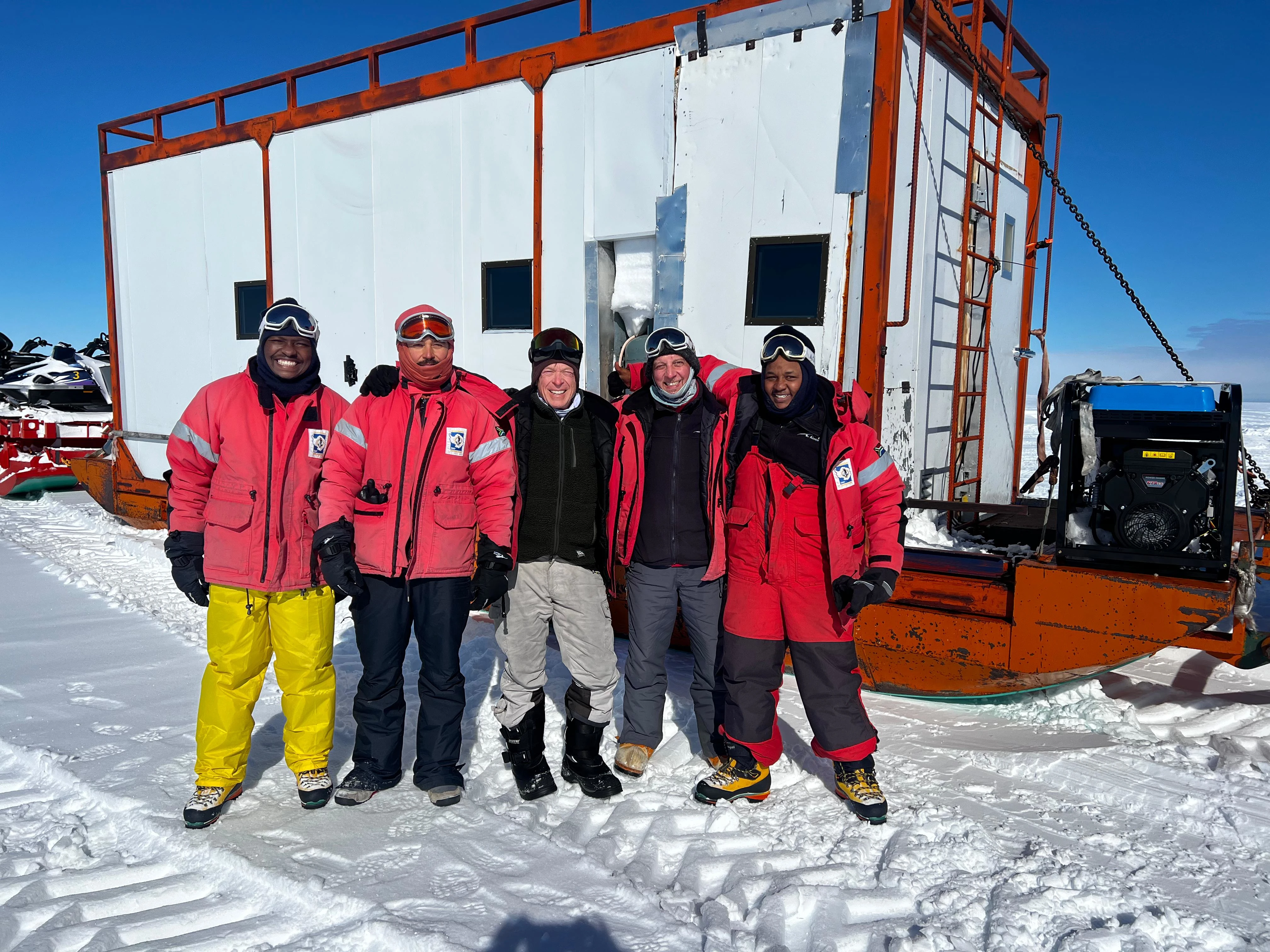
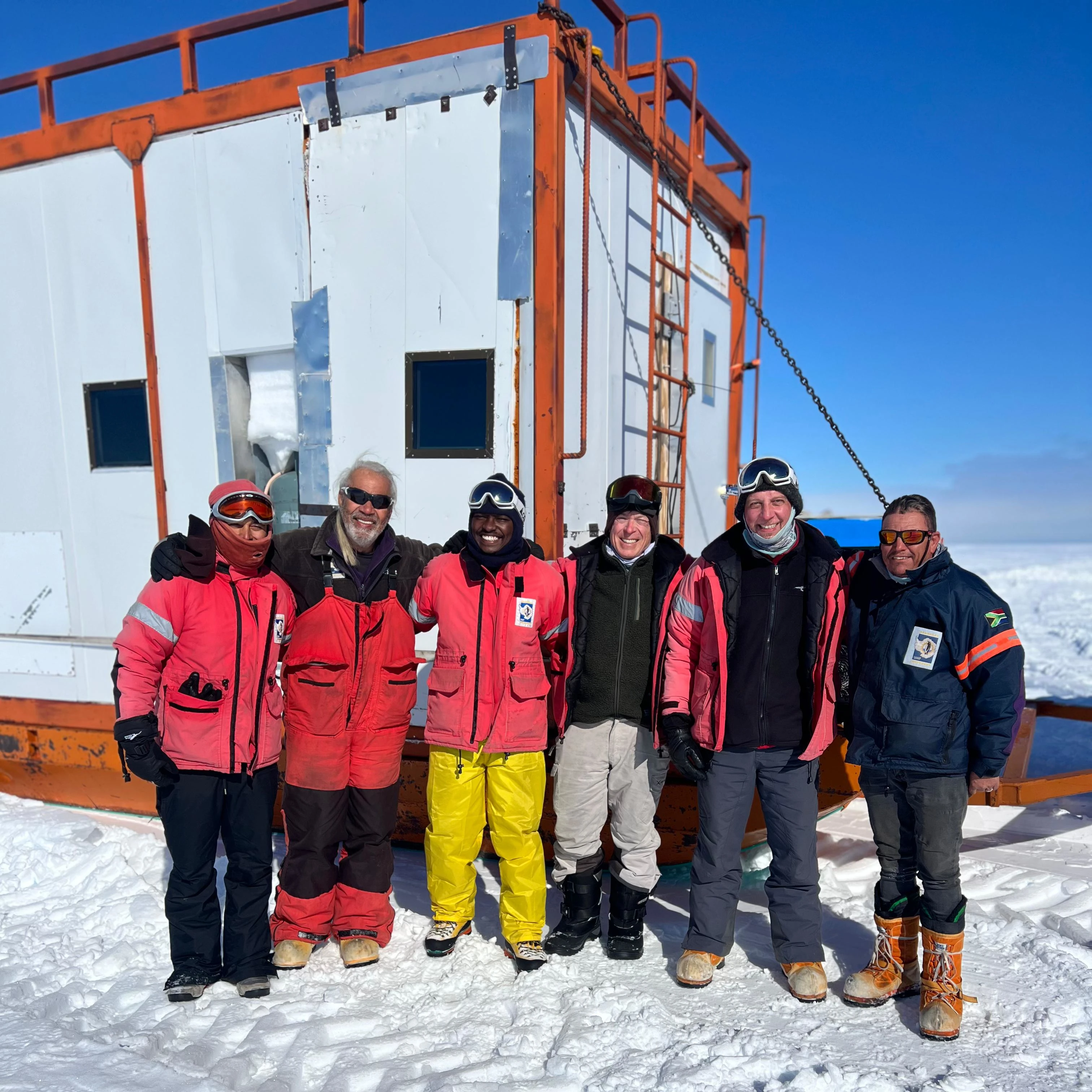
Civilization has us again! The team — Alex, Diego, Jay, Sebastian, and Daniel — pictured in the left photo below (left to right) in front of the caboose, was extracted yesterday morning by CAT train drivers Raymond and Markus (shown in the photo below, second and sixth from the left). They hauled the team’s caboose and equipment containers to the ship’s loading station, located 10 km to the west of our camp.
| 
|
By evening, after a long and demanding day of packing equipment, snowmobiles, and sleds into shipping containers, the team was airlifted from the ice shelf to the SA Agulhas II, stationed at Penguin Bukta (see images below). Everyone was exhausted — but deeply satisfied after a successful campaign and grateful to be returning to the ship back safe and sound.
| 
|
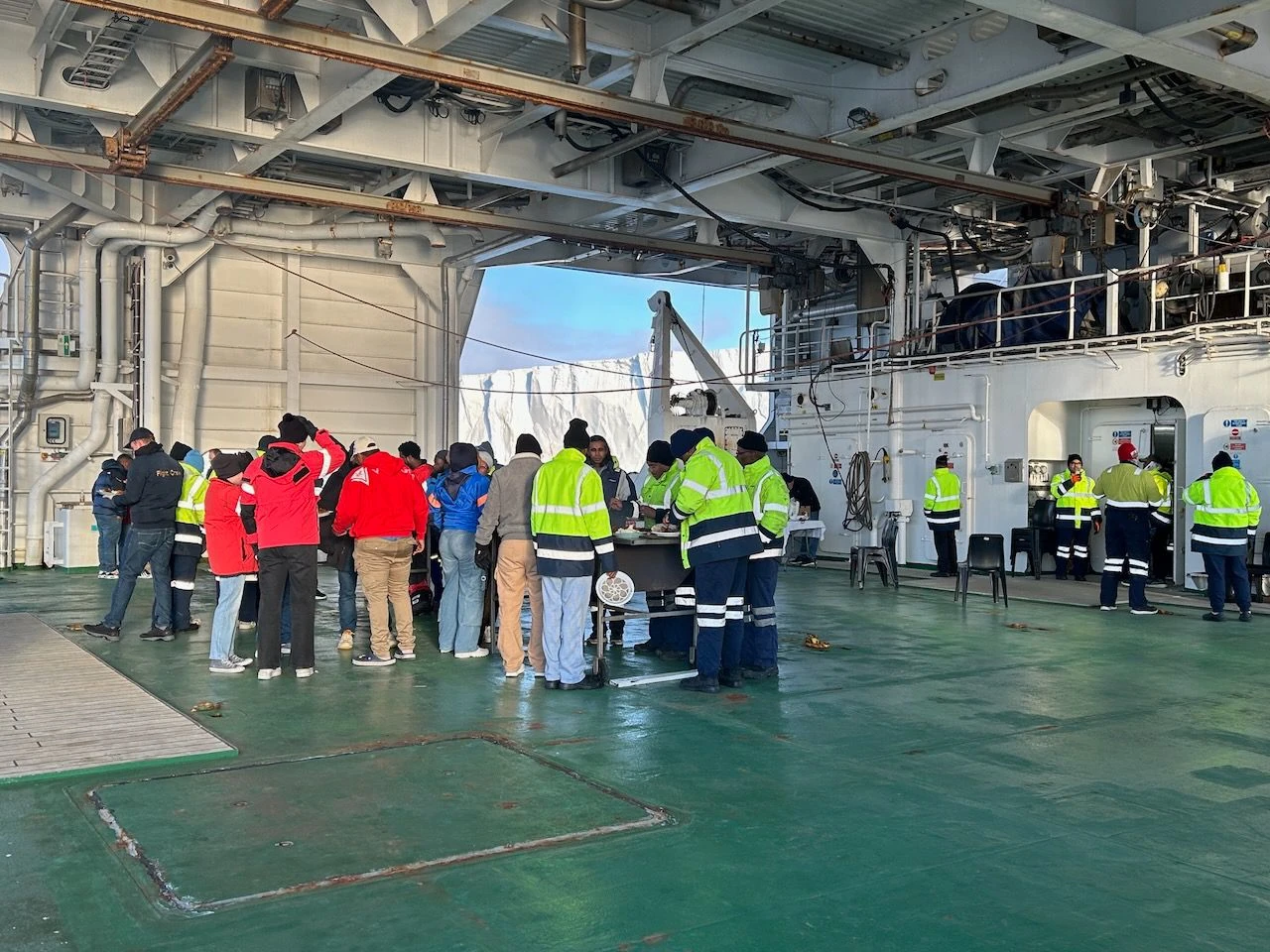
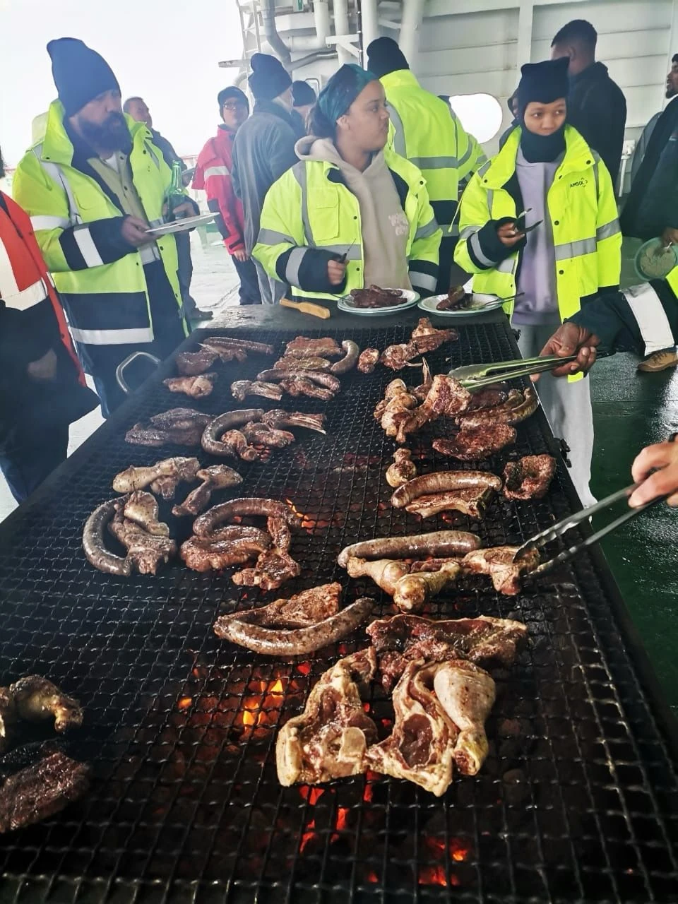
On board, they were reunited with Tristan, who is recovering well thanks to the excellent care of the ship’s doctor, Dr Abigail Paton. Spirits lifted even further when they discovered the crew had organized a braai on the Poop Deck — a welcome return to warmth, good food, and great company shared with fellow passengers and crew (as shown in the images below).
| 
|
11 February 2026
Today, the UCT SANAS team went on an excursion to visit the South African SANAE IV research base, perched atop a 250-metre rock formation known as the nunatak Vesleskarvet on the Antarctic continent, approximately 160 km inland from the calving front, as shown below.
Video showing the approach of the South African SANAE IV research base situated on top of the nunatak Vesleskarvet on the Antarctic continent by helicopter.
Video showing the UCT SANAS Team given a tour to see the South African SANAE IV research base and its scenic surroundings.
The base was buzzing with activity in preparation for the departure of the SA Agulhas II, which will transport most of the personnel—currently completing their annual maintenance work—back to Cape Town.
Despite this departure, the base remains occupied throughout the year. It is home to a small, dedicated team of technicians and scientists from the South African Weather Service, the South African Space Agency, and the Department of Forestry, Fisheries and the Environment, who continue vital research and monitoring in one of the most remote and extreme environments on Earth.
In conclusion, the UCT SANAS team would like to extend sincere thanks to the cruise DCO and Deputy DCO, Shiraan Watson and Jasmin Arnold, respectively, for outstanding logistics support and coordination before and throughout the campaign; Captain Roland Clutties and his crew for safely transporting us to and from the Fimbul Ice Shelf and for their exceptional care during the voyage; Chief Scientist Leon Jacobs for coordinating and liaising with the ship on our ocean floor bathymetry surveys and additional operational needs; and Dr Abigail Paton for her dedicated medical support.
Special thanks also go to the CAT train drivers — particularly Markus Viljoen, Raymond Williams, and team leader Lourens (“Duppie”) du Plesis — the true operators on the ground, as well as the Ultimate Heli team led by Sibongiseni Shandu for their rapid response and assistance when a medical evacuation was needed. We are equally grateful to our colleagues and fellow field campaigners from the University of Johannesburg, especially team leader Dr Hermanus van Niekerk for sharing his valuable Antarctic field experience and guidance. We also appreciate very much that our neighbours at the White Desert Fuel Depot were keeping an eye on us, especially during the heavy snowstorm.
We also gratefully acknowledge the NRF SANAP Programme — in particular Director Tracy Klarenbeek — the Department of Forestry, Fisheries and the Environment, the Department of Science and Innovation, and the South African Polar Research Infrastructure for their continued support.